Cartographers & Photogrammetrists
Creates and updates maps and geographic data sets from satellite imagery, aerial photos, and survey data, for uses ranging from land management to urban planning.

Salary
- Entry-level
- $53,500
- Mid-career
- $81,500
- Senior
- $127,000
Source: BLS OEWS, May 2025
Job outlook
- Growth, 2025–35
- +7%
- Much faster than average
- Openings each year
- 900
- New jobs plus people retiring or moving on
- Jobs in 2025
- 14,700
- +1,100 by 2035
Source: BLS Employment Projections, 2025–35. Growth for all jobs is +3.5%. See the BLS profile
A day on the job
What people in this job typically spend their time doing.
- Gather aerial photos, survey notes, records and older maps for a new map
- Study survey data and satellite images to build maps and 3D terrain models
- Decide a map's layout, scale and colors and guide it through production
- Check finished maps for accuracy and update older ones
- Build and maintain digital map databases
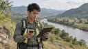
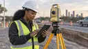
- Visit sites or fly drones to check features and capture new images
Adapted from O*NET OnLine (17-1021.00), U.S. Department of Labor, used under the CC BY 4.0 license.
Getting in
A degree is required for this career.
Recommended degrees
Progression
- GIS Technician or Mapping Assistant
- Cartographer or Photogrammetrist
- Senior GIS Analyst or Geospatial Project Lead
- GIS Manager or Geospatial Program Director
Where this can lead
Top Employers
- Federal agencies (e.g. USGS, National Geospatial-Intelligence Agency) Produce national maps and geospatial intelligence; some roles need a clearance.
- Engineering and mapping firms Create maps and models for construction, utilities, and land development.
- Technology and location companies (e.g. Esri) Build mapping software and data products.
Networking & job search

- Build a portfolio of maps and spatial projects that shows both design skills and data work.
- The Esri User Conference and state GIS associations are where geospatial employers and job seekers meet.
- Certifications like the GIS Professional (GISP) and skills in remote sensing or lidar set you apart.
Example trajectories
Liam
Geography degree → GIS technician for a city → cartographer at a mapping company → senior GIS analyst.
Zoe
Forestry degree → photogrammetry technician processing aerial imagery → remote sensing lead at a geospatial firm.